29M UK properties, one API call. Get an API key →

Mover data · Home insurers

Know the home before you quote the new owners

A buyer needs buildings cover from exchange. You hear the home is moving the day it goes Sold STC, with what it takes to rate it.

Tewkesbury as an architect's model: the river at the back, the home on York Road out front, and the recorded floods as sheets of glass over the river, River Severn March 1947 reaching 78 m from the home, River Swilgate July 2007 reaching 98 m from the home. RIVER SEVERN · MARCH 1947 · 78 M RIVER SWILGATE · JULY 2007 · 98 M 78 m 1 2 3 4
  1. 1The recorded floods, as sheets over the river: River Severn, March 1947, came within 78 m; River Swilgate, July 2007, came within 98 m. Flood zones 2 and 3 end 98 m and 138 m out; no defences within 250 m.
  2. 2The home and its tree: 8.3 m tall, 9 m from the property point, the home inside its root reach. Sold STC on 9 October.
  3. 3The ground, in the drawer: clay, shrink-swell moderate (class 2 of 5), moving -1.2 mm a year (stable, satellite readings 2019 to 2023).
  4. 4Your letter lands on 17 January, day 100 after Sold STC, as they choose cover.

Drawn from the record, not to scale across the break: flood outlines measured to the home's title boundary (Environment Agency data, recorded since 1703), the tree from aerial survey with root reach inferred, ground movement from satellite readings, 18 Oct 2026.

Why Homedata

Flood
78 mto the nearest recorded flood; outside zones 2 and 3
Trees
9 mto the nearest, within root reach, on clay
Ground
-1.2 mma year, classed stable on satellite readings
New cover
70.8khomes a month go Sold STC, each a policy about to start

One home, every signal

Everything we know about one home that just sold

A real detached on York Road, Tewkesbury GL20, marked Sold STC on 9 October. The house number is withheld here. This is what a home insurer sees before writing a word, and the letter it could send.

What a home insurer prices

From the record
Rebuild inputs
101 m² floor area (EPC) · 109 m² footprint · 8.1 m tall
Built
1919 to 1944 · brick, block or stone
Flood
Outside zones 2 and 3 by 98 and 138 m · recorded floods from 78 m · no defences within 250 m
Subsidence
1 tree within root reach, 8.3 m tall, on clay · clay class 2 of 5
Contents
4 bedrooms · 9 habitable rooms · 2 bathrooms
The move

Lead Source

Sold STC on 9 Oct; the letter lands once the new owners are in, with cover bought in a hurry at exchange.

Listed for sale
4 Sep 2026 · £450,000
Reduced
18 Sep 2026 · £420,000
Sold STC
9 Oct 2026 · £420,000
On the market
35 days to Sold STC
Letter lands
17 Jan 2027 · day 100 after Sold STC, in the day 50 to 110 window, suggested

The home

API

Built 1919 to 1944, brick, block or stone, 8.1 m tall on a 593 m² plot: the inputs a rebuild cost starts from.

Type
Detached · 4 bed · 2 bath
Floor area
101 m² measured (EPC) · 109 m² footprint · plot 593 m²
Built
1919 to 1944 · Brick, block or stone
Height
8.1 m
Outside
No solar panels
Photos, read by AI
22 listing photos tagged by room · front, living room, dining room, bedroom, bathroom, stairs and garden at 83 to 98% confidence
Photos and floor plan
On request

Energy

API
EPC
E 54 now · D 66 possible · 2011
Works listed
Cavity wall insulation, Heating controls, New condensing boiler, Solar panels, 2.5 kWp
Cost of the works
£12,950 to £24,250

Value

API
Asking at Sold STC
£420,000
Last sold
In 2011 · full price history in the API
Price growth, GL20
+1.8% a year in median sold price · 196 sales to May 2026

Risk

API · flood on request

Outside flood zones 2 and 3, but recorded floods have come within 78 m, with no defences within 250 m; and a tree 8.3 m tall within root reach on clay.

Flood zones
Outside flood zone 2 by 98 m · Outside flood zone 3 by 138 m
Recorded floods
None at this home · River Severn, March 1947, 78 m away · River Swilgate, July 2007, 98 m away
Flood defences
None within 250 m
Clear
Rivers and sea · Surface water · Radon · Coal mining · Non-coal mining
Road noise
Medium. From the road at the property.
Trees
1 within root reach · nearest 9 m from the property point, 8.3 m tall, on clay
Ground movement
-1.2 mm a year · stable, measured from satellite 2019 to 2023
Clay shrink-swell
Moderate · class 2 of 5

Area

API
Council tax
Band C · £2,080 a year, 2026-27
Broadband
29% of the postcode has full fibre
To the new owners
York Road •••
Tewkesbury GL20
Lands 17 Jan 2027

Cover for your home on York Road, priced on the home itself

Welcome to York Road.

Buildings cover is usually arranged in a rush at exchange. We have priced yours on the home itself: a 4-bedroom detached built 1919 to 1944, and on its own flood record rather than the postcode's.

The home sits outside the mapped flood zones, and we have taken that into account.

Your quote is ready: compare it with your current policy, and switch today or at renewal.

Yours,
Your company

Written from this home's record. Print and post letters through us, or export the list and send your own. Every trade's letter · Ask about letters

Captured from Homedata's API and Lead Source on 17 Oct 2026. Its listing photos were tagged by an AI image model, 1 Oct 2026: room types read at 80% confidence or more; the model's other tags are not shown. Price growth is for the GL20 district, not this home: the median sold price over the year to 22 May 2026 against the year before, captured 18 Oct 2026. Trees, ground movement and clay from our ground stability data, captured 18 Oct 2026: tree heights are measured, root reach is inferred; ground movement is the nearest satellite reading, for the area rather than this building. Flood readings are measured to the home's title boundary.

The schedule

Rate the home, not the postcode

York Road •••, Tewkesbury GL20Sold STC 9 Oct

Rebuild inputs

Type
Detached · 4 bed · 2 bath
Built
1919 to 1944Brick, block or stone · pitched, tile or slate
Size
101 m² on the EPC · 109 m² footprint8.1 m tall on a 593 m² plot, no basement

Perils

Flood
Outside zones 2 and 3 · never recorded floodingRiver Severn March 1947, 78 m · River Swilgate July 2007, 98 m · no defences within 250 m
Subsidence
1 tree within root reach, on clay8.3 m tall, 9 m from the property point · ground -1.2 mm a year, stable · shrink-swell class 2 of 5
Road noise
MediumFrom the road at the property.
Clear
Rivers and sea · Surface water · Radon · Coal mining · Non-coal mining

Area

Council tax
Band C · £2,080 a year, 2026-27

Trees, ground movement and clay in one call: 1 token a home, self-serve. Flood in depth on request. Try ground stability free

The maps behind it

Four flood datasets, one town

Tewkesbury, where the Severn and the Avon meet. Every home's answer comes from these layers, measured to its own title boundary.

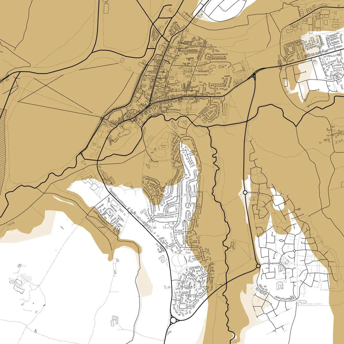
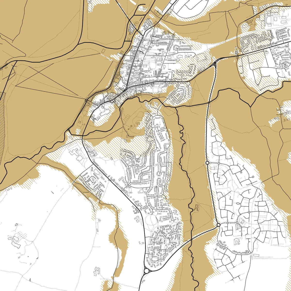
Flood zones 2 and 3 around Tewkesbury, in gold over the town's streets
Flood zones 2 and 3Land at risk from rivers and the sea, ignoring defences: zone 3 solid, zone 2 hatched.
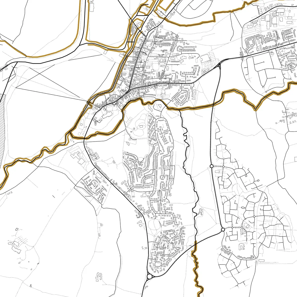
Recorded floods since 1703 around Tewkesbury, in gold over the town's streets
Recorded floods since 1703Every recorded flood outline, with March 1947 on the Severn in the deepest gold.
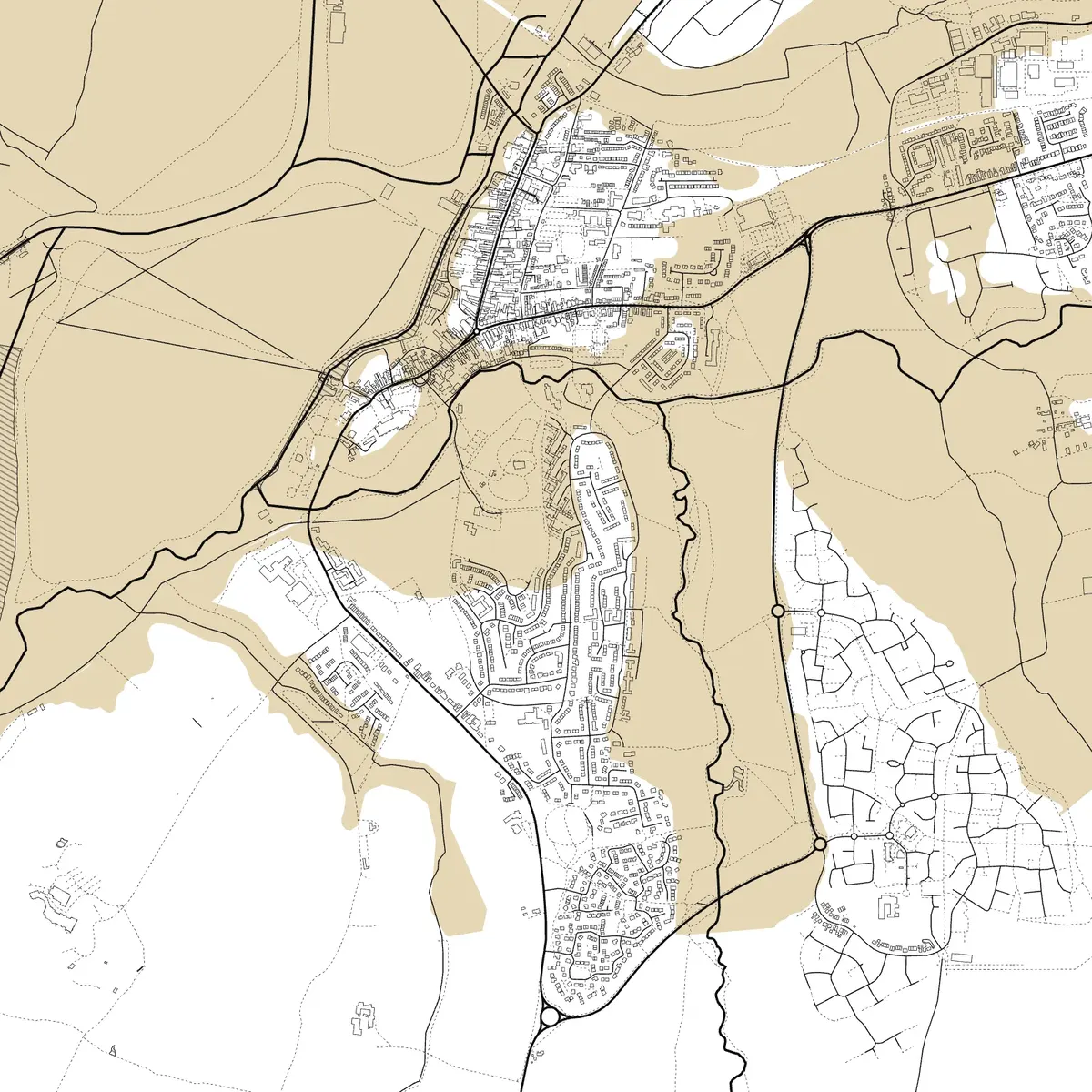
Flood defences around Tewkesbury, in gold over the town's streets
Flood defencesThe walls, embankments and raised ground that hold the water back.
Flood warning areas around Tewkesbury, in gold over the town's streets
Flood warning areasWhere the Environment Agency issues flood warnings.

Contains Environment Agency information © Environment Agency and/or database right 2026, fetched 18 Oct 2026. Streets and buildings © OpenStreetMap contributors. Drawn at town scale; no home is marked.

Target better

Three ways to aim, and one way to land it

A list of people who are moving is a start. These narrow it to the households you can actually sell to, and tell you what each one needs.

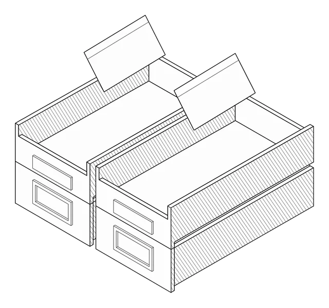
Two filing trays taking customer cards

Your customers, before they move

Upload up to 2,000 of your own customers. Each is matched to its home and ranked by how likely it is to move, so you reach the ones about to insure a new home, before they shop around first. 1 token a scored contact; unmatched ones cost nothing. Add each home's details to every match.

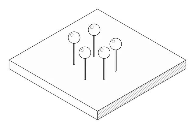
A map slab with five pins in it

New movers in your area

Every home that went Sold STC or let agreed around a postcode, a town or an area, dated to the day. Narrow it to the homes you serve: bedrooms, price, property type, floor area, a garden, parking. Searching is free.

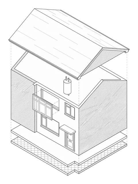
A semi-detached house drawn exploded, floor by floor

What each home needs

Every home you reveal comes with its record: its type, floor area, age and energy rating. Add the roof (1 token a home), its flood risk (1 token a home) and trees and ground movement (1 token a home), each its own call. Quote from the house, not from a postcode average.

Land it on the day. Your letter reaches the new owners on day 100 after Sold STC, printed and posted by us, or export the homes you reveal as a CSV for your own email or mail house.

Who is moving, live

The homes that changed hands this fortnight

NR7 · NorwichCaptured 13 Oct 2026

27homes went Sold STC in the 14 days to 13 Oct

  • •• Saint Andrews Avenue, NR7 Detached · 4 bed · 2 bath £700,000Reduced 25 Sep
  • •• Thor Loke, NR7 Bungalow · 3 bed · 1 bath £450,000Reduced 17 Jul
  • •• Gorse Road, NR7 Bungalow · 2 bed · 1 bath £325,000
  • •• Peregrine Road, NR7 Semi-detached · 3 bed · 1 bath £270,000
First 4 of 27Lead Source

Searches run on 13 Oct 2026. A search today returns that day’s homes.

What a month costs

Priced per home, published

Addresses £20.00 · letters £45.00

£65.00a month, from · + VAT
  • Searched free, no sales call
  • 20 tokens (20p) an address
  • Letters from 45p + VAT
  • Sales and lettings
  • Buildings, contents and landlord cover from one feed
29MUK properties, by UPRN
36.6Maddresses indexed
26 yrsof listing events, since 2000
23MEPC certificates on file
7licensed and official sources
Live status →

Quote the new owners from the home itself

Search free, reveal the homes you want, and price them on their own record.